Tool for orthomosaic geometrical and colorimetric correction
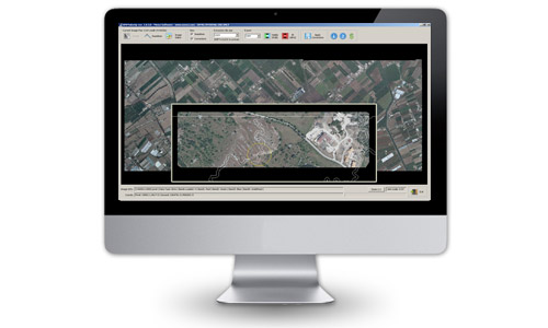
OPK MakeUp is the unique smart tool specifically developed for orthomosaic geometrical and colorimetric correction.
It minimizes time of orthomosaic checking and specifically there is no limit for image dimension, ease of use and efficiency.
With MakeUp is possible to apply real time corrections using your favourite image editor (like Photoshop, Gimp, etc.) and directly update your orthomosaic.
MakeUp helps to prepare your data to be examinated inside geographic information system (GIS) environments.
Main features
- Import geo-referenced Tiff images
- Multichannel image handling: RGB+IR
- Automatic images backup
- Seamline import
- Orthomosaic-seamline overlap visualization
- Selectable external image editor
- Seamline visualization on/off
- Correction visualization on/off
- Select the tile size for editing
- RGB / IR corrected image export
- Available for Windows Vista, 7 and 8 (32 / 64 bit)
Aerial Mapping
MakeUp

Software per GIS e Cartografia La suite OPK è un set di software per GIS e cartografia aerea dedicati al processamento di immagini large format acquisite con camere aeree o satelliti...
Maggiori InformazioniBlend

Software per GIS e Cartografia La suite OPK è un set di software per GIS e cartografia aerea dedicati al processamento di immagini large format acquisite con camere aeree o satelliti...
Maggiori InformazioniSurf

Software per GIS e Cartografia La suite OPK è un set di software per GIS e cartografia aerea dedicati al processamento di immagini large format acquisite con camere aeree o satelliti...
Maggiori InformazioniWarp

Software per GIS e Cartografia La suite OPK è un set di software per GIS e cartografia aerea dedicati al processamento di immagini large format acquisite con camere aeree o satelliti...
Maggiori InformazioniBundle

Software per GIS e Cartografia La suite OPK è un set di software per GIS e cartografia aerea dedicati al processamento di immagini large format acquisite con camere aeree o satelliti...
Maggiori InformazioniStartKit

Software per GIS e Cartografia La suite OPK è un set di software per GIS e cartografia aerea dedicati al processamento di immagini large format acquisite con camere aeree o satelliti...
Maggiori InformazioniSoftware Fotogrammetria
OPK SAT, Software per immagini da Satell…

A Multi-faceted approach Partner removes the hassle and confusion that comes from managing your tax burden effectively. Our tax services range from discrete, one-time advice to complete management and everywhere in...
Maggiori InformazioniOPK, Software per immagini da Aereo (2)

Software per GIS e Cartografia La suite OPK è un set di software per GIS e cartografia aerea dedicati al processamento di immagini large format acquisite con camere aeree o satelliti...
Maggiori InformazioniAPS - Photogrammetry Software

La suite OPK è un set di software per GIS e cartografia aerea dedicati al processamento di immagini large format acquisite con camere aeree o satelliti. OPK garantisce alte prestazioni...
Maggiori Informazioni
")