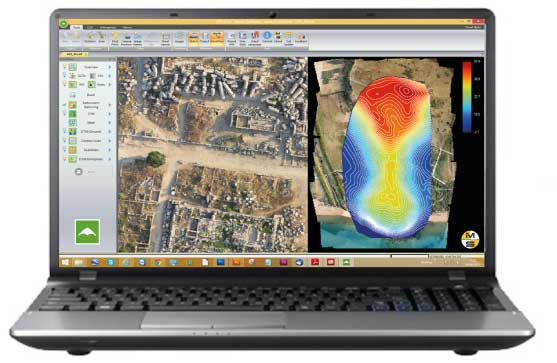
Menci provides different software tools for different applications and contexts.
- APS is a photogrammetric software suite with high performance for the big production of aerial cartographic data starting from small and medium format digital images acquired by UAV drone.
- StereoCAD: stereoscopic CAD for drone images, to 3D inspection and plotting
- TerrainTools: professional DEM editor tool set, for volume, profiles and advanced DSM/DTM analysis
- APSCheck: fastpost-flight dataset checker
- OPK - Large Format: photogrammetric software suite for large format images from aerial cameras and satellite processing.

Main features
- Easy workflow
- User friendly interface
- Openness (no proprietary format)
- Self-contained (no other software requested)
- Customizable (we can respond and provide solutions to custom requests)
Advantages
- Processes blocks of any shape and overlap
- Easy to use intuitive graphical user interface
- State-of-the-art computation algorithms
- Sophisticated block visualization
- High precision & high reliability
- High processing speed
- High level of automation
- Optimized utilization of hardware capacity
- Minimized user interaction for project set-up
- Batch processing capabilities
OPK SAT, Software per immagini da Satell…
A Multi-faceted approach Partner removes the hassle and confusion that comes from managing your tax burden effectively. Our tax services range from discrete, one-time advice to complete management and everywhere in...
Maggiori InformazioniOPK, Software per immagini da Aereo (2)
Software per GIS e Cartografia La suite OPK è un set di software per GIS e cartografia aerea dedicati al processamento di immagini large format acquisite con camere aeree o satelliti...
Maggiori InformazioniAPS - Photogrammetry Software
La suite OPK è un set di software per GIS e cartografia aerea dedicati al processamento di immagini large format acquisite con camere aeree o satelliti. OPK garantisce alte prestazioni...
Maggiori Informazioni


