OPKBundleSAT
OPKBundleSAT is the software for the satellite imagery RPC model refinement.
It can manage all the imagery from the main satellites (Ikonos, QuickBird, GeoEye, SPOT, Deimos, Kompsat, etc..).
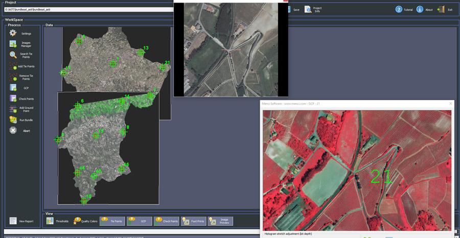
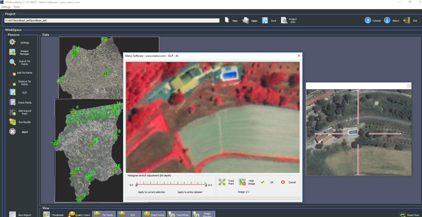
OPKBundleSAT allows to work with single or multiple imagery. The RPC refinement process makes use of Tie Points and/or Ground Control Points. Tie Points searching process is fully automatic and/or manual (assisted). Regarding the Ground Control Points, user can import them as known coordinates, or can locate them using orthophotos and DEMs (Digital Elevation Model).
OPKBundleSAT also manage Check Points in order to check the accuracy of the results.
Main features
- management of main satellites imagery (Ikonos, QuickBird, GeoEye, SPOT, Deimos, Kompsat, ecc..)
- single or multiple imagery RPC model refinement
- automatic TiePoints location
- manual TiePoints location (assisted)
- GCPs (Ground Control Points) and CPs (Check Points) management
- RPC models refinement can be done with or without GCPs (Ground Control Points)
- tool for GCPs location using existing OrthoPhotos and DEMs (Digital Elevation Model)

")