Orthomosaic generation
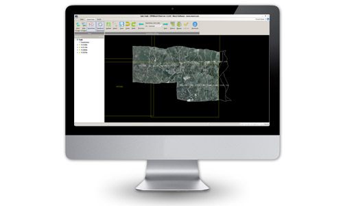
OPK Blend is a very powerful professional mosaicking product. It utilizes advanced image processing techniques to automatically adjust and combine orthophotos from any source into one single seamless, color-balanced mosaic.
OPK Blend improves the efficiency, quality and profitability of digital orthophoto mosaic production.
OPK Blend is part of Menci digital photogrammetric suite OPK, a set of cartography software. Orthophoto imaging is the process of digitially generating images from an aerial photo or satellite image set in which displacements caused by camera orientation and terrain is being corrected. The corrected image will then be projected to a standard map projection for spatial accuracy.
OPK Blend performs a blockwide color balancing by adjusting adjacent images to match in color and brightness. Multiple orthophotos are combined into one seamless, color balanced and geometrically perfect orthomosaic suitable for geographical information systems (GIS) and mapping software.

Main features
- Fully automatic seam line detection
- Interactive seam line definition & editing
- Automatic tiling of the mosaic
- Server/Client workflow
- Excellent processing capacity: handles very large orthophoto blocks
- Radiometric image enhancements:
- Automatic adjustment of intensity and contrast
- Automatic adjustment of color and color saturation
- Automatic histogram adjustment - Support for multi-channel imagery
- Multi-threading of time consuming processes for efficient use of multi-core CPUs
- Available for Windows Vista, 7 and 8 (32 / 64 bit)
Aerial Mapping
MakeUp
Software per GIS e Cartografia La suite OPK è un set di software per GIS e cartografia aerea dedicati al processamento di immagini large format acquisite con camere aeree o satelliti...
Maggiori InformazioniBlend
Software per GIS e Cartografia La suite OPK è un set di software per GIS e cartografia aerea dedicati al processamento di immagini large format acquisite con camere aeree o satelliti...
Maggiori InformazioniSurf
Software per GIS e Cartografia La suite OPK è un set di software per GIS e cartografia aerea dedicati al processamento di immagini large format acquisite con camere aeree o satelliti...
Maggiori InformazioniWarp
Software per GIS e Cartografia La suite OPK è un set di software per GIS e cartografia aerea dedicati al processamento di immagini large format acquisite con camere aeree o satelliti...
Maggiori InformazioniBundle
Software per GIS e Cartografia La suite OPK è un set di software per GIS e cartografia aerea dedicati al processamento di immagini large format acquisite con camere aeree o satelliti...
Maggiori InformazioniStartKit
Software per GIS e Cartografia La suite OPK è un set di software per GIS e cartografia aerea dedicati al processamento di immagini large format acquisite con camere aeree o satelliti...
Maggiori InformazioniSoftware Fotogrammetria
OPK SAT, Software per immagini da Satell…
A Multi-faceted approach Partner removes the hassle and confusion that comes from managing your tax burden effectively. Our tax services range from discrete, one-time advice to complete management and everywhere in...
Maggiori InformazioniOPK, Software per immagini da Aereo (2)
Software per GIS e Cartografia La suite OPK è un set di software per GIS e cartografia aerea dedicati al processamento di immagini large format acquisite con camere aeree o satelliti...
Maggiori InformazioniAPS - Photogrammetry Software
La suite OPK è un set di software per GIS e cartografia aerea dedicati al processamento di immagini large format acquisite con camere aeree o satelliti. OPK garantisce alte prestazioni...
Maggiori Informazioni


